
Using CalTopo Teams in
Using CalTopo Teams in
The emergency request was simple, but clear:
Broken Leg. Bone Out.
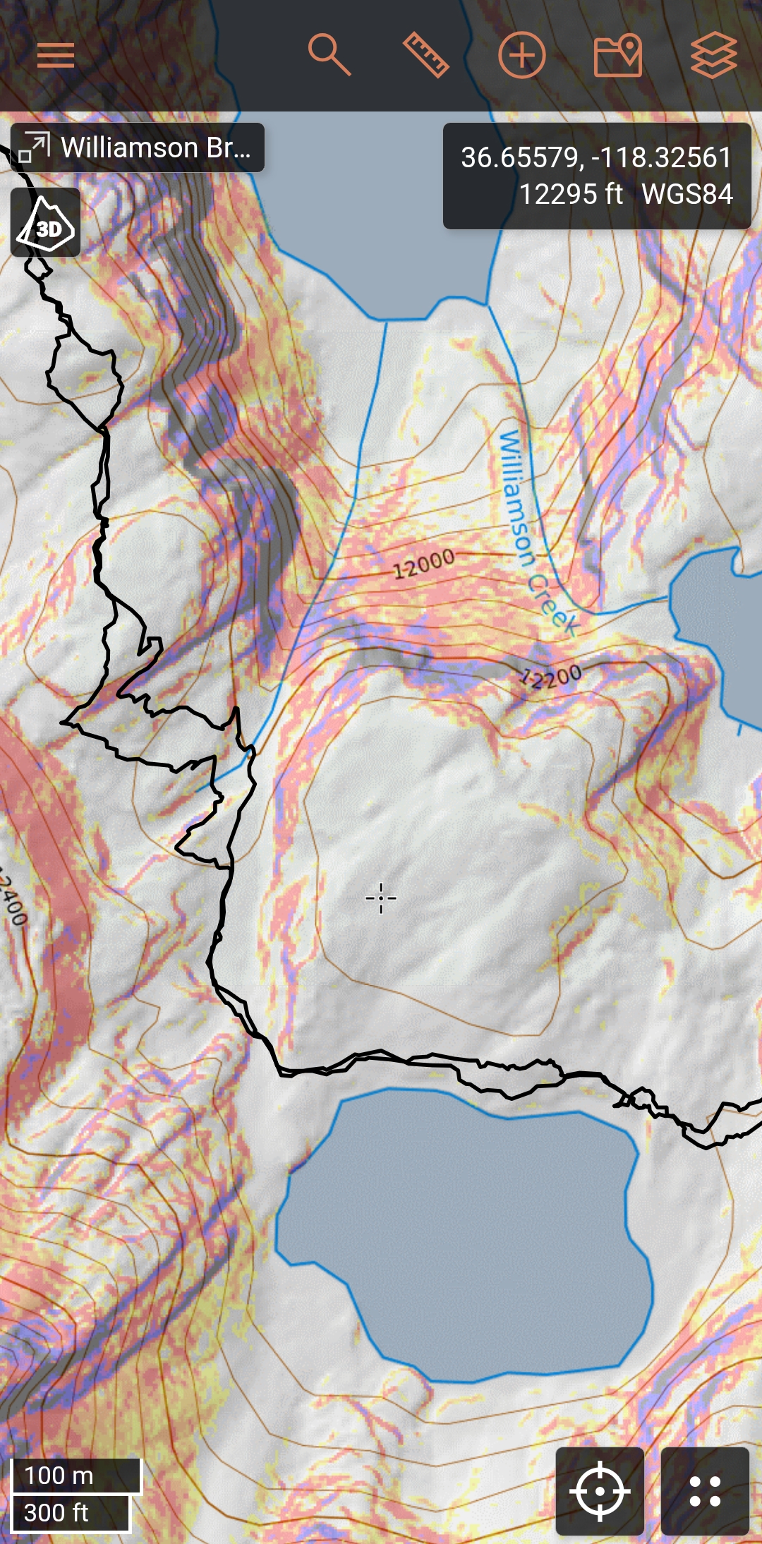
Late in the afternoon, a climber activated her inReach after a fall left her with a broken leg and no cell service. Inyo SAR mobilized. Their first step wasn't just plotting a point on a map — it was creating a single point of reference for the entire operation.
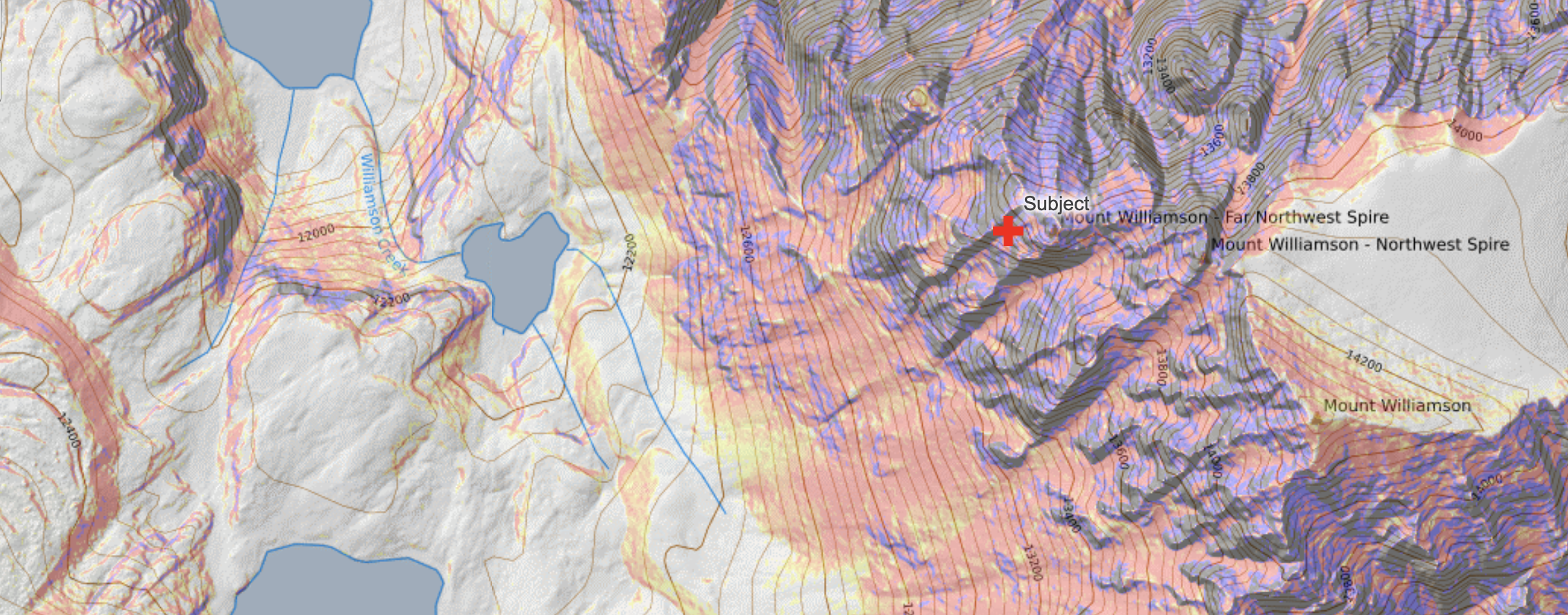
From there, everyone could see the same information: the subject's location, terrain conditions, and historic data from past rescues on the same mountain.
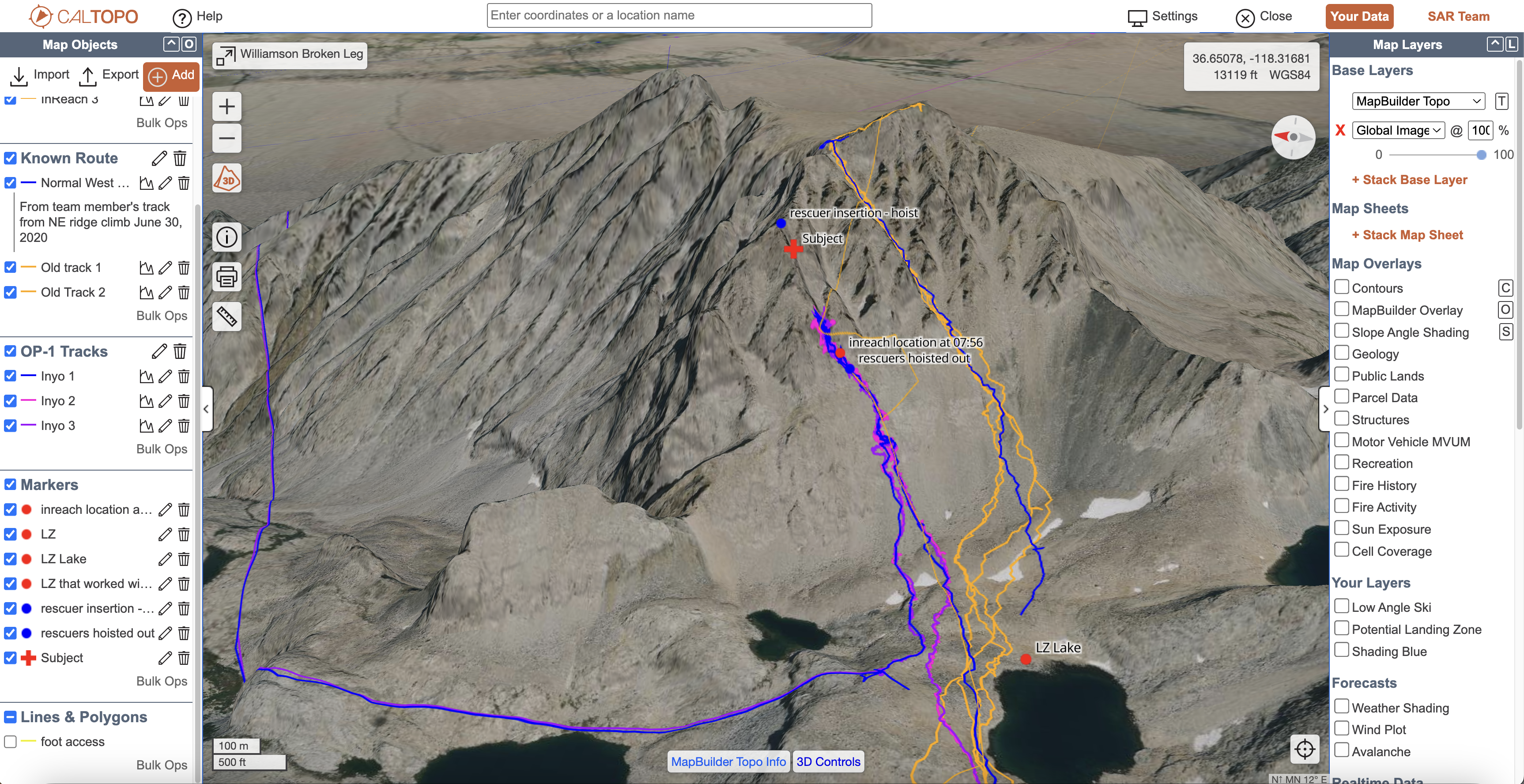
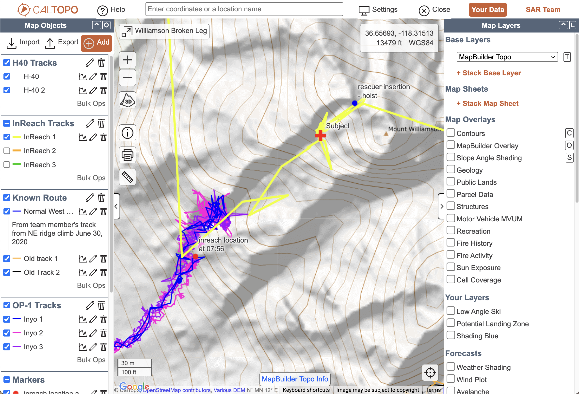
Learn More about CalTopo TeamsCalTopo brought every responder into one map. Command, field teams, and air resources were all looking at the same picture—live tracks, landing zones, and subject details, layered together.
And because Inyo SAR had years of missions and trainings already saved in CalTopo, they weren't starting from zero. Past routes, landing zones, and notes from prior calls were immediately available for comparison.
This combination of current and historic data meant less guesswork and more confidence in every decision.
From her GPS coordinates, rescuers could see:
Historic tracks and terrain layers in the shared workspace gave rescuers realistic options—where others had traveled before, which ridges to avoid, and where landing zones might be possible.
 Get to Know CalTopo Teams
Because Inyo SAR had stored years of data in CalTopo, the workspace included:
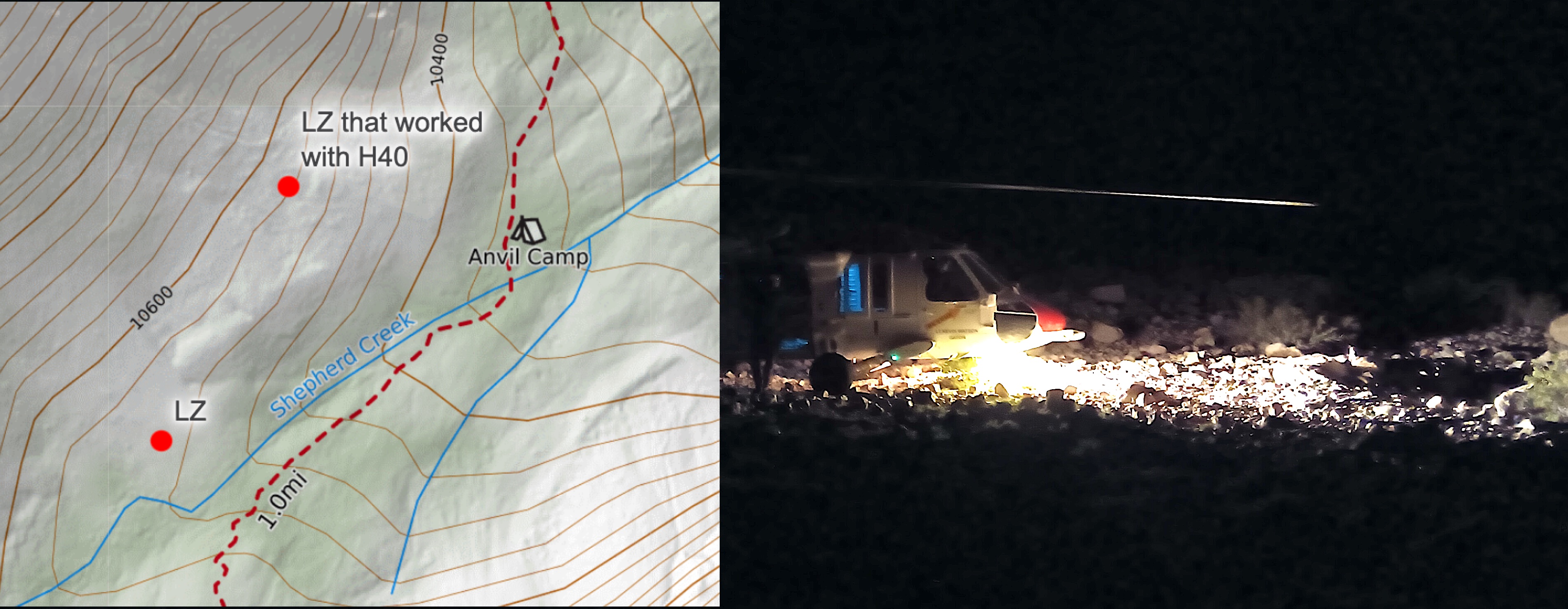
Once on the move, responders carried the same common picture into the field with the CalTopo Mobile App. Even offline, they had access to:
This closed the loop—command could monitor progress, while responders could navigate with confidence, knowing they were all working off the same data.
 Request a Quote
Live tracking connected field teams, command, and helicopters in one view. Garmin inReach and other feeds integrated into CalTopo, so everyone stayed current as the rescuers descended into the chute.
Because the tracking data fed into the shared workspace, the whole team—on the mountain and off—could make decisions based on the same, real-time map.
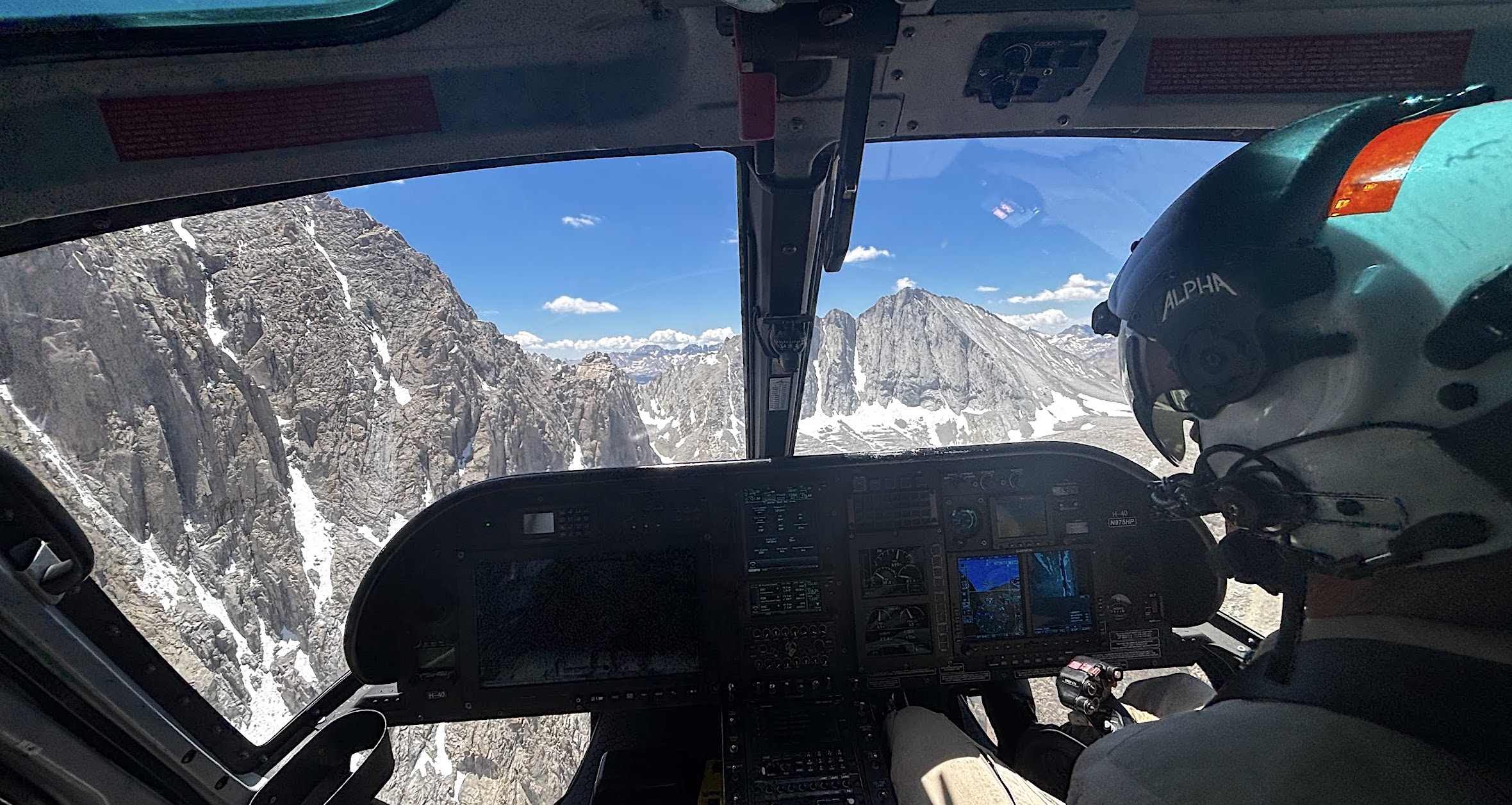
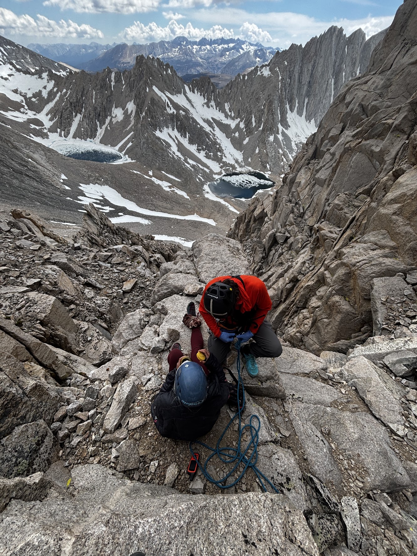
At dawn, improved weather allowed a helicopter to insert rescuers above the subject. They rappelled down, stabilized her, and moved her to a point where she could be hoisted out.
"CalTopo changed the game for how we conduct SAR missions. It's ingrained in everything we do."
— Victor Lawson, Inyo County Sheriffâs Office
Try CalTopo Teams Free For 90 DaysThe Mt. Williamson rescue highlights how CalTopo supports every stage of a mission — from the first alert through the final extraction. Inyo County SAR used CalTopo to quickly understand the terrain, evaluate access routes, and identify possible helicopter landing zones. Teams in the field relied on the mobile app to navigate through the night and record their progress, while command maintained real-time awareness of rescuer locations using live tracking integrations.
Just as important, years of stored data in CalTopo provided context and options, turning past experience into present-day insight. By combining terrain analysis, historical mission data, and seamless syncing between command and field, CalTopo gave rescuers the information they needed to act quickly and safely in a complex, high-risk environment.
The outcome of this mission demonstrates why CalTopo is more than just a mapping tool — it's a platform for collaboration, safety, and informed decision making. For Inyo SAR, and for teams across the world, CalTopo is an integral part of the workflow for both training and life-or-death operations.
Enhance your Missions with CalTopo Teams